
Dam Removal Europe Map

9680

Barriers removed

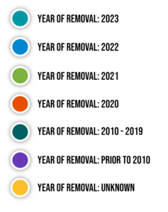
Dam Removal Europe has created the most complete database on removed barriers in Europe to evaluate the implementation advancement of EU policies and to analyze the progress of this river restoration measure continent-wide. All the removed barriers are shown on the interactive map below. Data are color-coded based on the year of the removal and the information provided per case includes also the name of the barrier and its coordinates.  

Dam Removal Europe interactive map of removed barriers in Europe. 

Data used for the map above is made available thanks to: Show more

  • Blattfisch
  • Federal Ministry of Agriculture, Regions and Tourism
  • Contrat de Rivière Semois-Chiers
  • L’environnement en Wallonie – SPW
  • Parc naturel Haute-Sûre Forêt d’Anlier
  • Ministry of Environmental Protection and Green Transition
  • Water Development Department of Cyprus
  • Nature Conservation Agency of the Czech Republic
  • Ministry of the Green Transition
  • Action for the River Kennet
  • Bristol Avon Rivers Trust
  • Cain Bio-Engineering
  • Calder Rivers Trust
  • Don Catchment Rivers Trust
  • Environment Agency
  • Hertfordshire County Council
  • Herts & Middlesex Wildlife Trust
  • National Trust
  • Ouse & Adur Rivers Trust
  • Ribble Rivers Trust
  • Severn Rivers Trust
  • Shropshire Wildlife Trust
  • South Cumbria Rivers Trust
  • South East Rivers Trust
  • The Rivers Trust
  • The Trent Rivers Trust
  • Tyne Rivers Trust
  • Wessex Rivers Trust
  • Westcountry Rivers Trust
  • Wild Trout Trust
  • Wyre Rivers Trust
  • Estonian Environment Agency
  • Ministry of Regional Affairs and Agriculture
  • Elinvoimakeskus (EVK)
  • Metsähallitus Forestry Ltd
  • Metsakeskus
  • South Karelian Foundation for Recreation Areas
  • WWF Finland
Data till 2021 could include naturally removed barriers
  • Agence de l’Eau Artois-Picardie
  • Agence de l’Eau Rhône Méditerranée Corse
  • Agence de l’eau Seine-Normandie
  • BIEF – Caricaie
  • Bretagne Grands Migrateurs
  • ERN
  • Fédération du Nord pour la pêche et de la protection du milieu aquatique (Pêche59)
  • Fédération du Pas de Calais pour la pêche et la protection du milieu aquatique (Pêche62)
  • Fédération de Pêche des Pyrénées-Atlantiques (Pêche64)
  • Fédération de Pêche des Hautes-Pyrénées (Pêche65)
  • Ministry of Ecological Transition
  • Parc naturel régional du Haut-Jura
  • Syndicat Interdépartemental d’Aménagement du Guiers et de ses Affluents (SIAGA)
  • Syndicat Mixte du Bassin de l’Authion et de ses Affluents (SMBAA)
  • Syndicat Mixte des Basses Vallées Angevines et de la Romme (SMBVAR)
  • Syndicat Mixte des bassins Bandiat-Tardoire (SYMBA)
  • Syndicat Mixte Interdépartemental de la Vallée de la Lèze (SMIVAL)
  • BUND Naturschutz
  • Institut für Binnenfischerei e.V. Potsdam Sacrow (IfB)
  • Regierungspräsidium Gießen
  • WWF Germany
  • Zweckverband “Bevorzugtes Erholungsgebiet Bad Wünnenberg/Büren“
  • Fuglavernd – BirdLife Iceland
  • Inland Fisheries Ireland (Barrier Mitigation Division)
  • Loughs Agency
  • Rewilding Apennines
  • Pasaules Dabas Fonds – WWF Latvia
  • Ministry of Environment of the Republic of Lithuania
  • WWF Adria
  • Limburg Water Authority
  • Rijn en Ijssel Water Authority
  • Vechtstromen Water Authority
  • Eko-svest
  • Norwegian Water Resources and Energy Directorate (NVE)
  • Bærum Municipality
  • Norconsult AS
  • Kazimierz Wielki University
  • Regional Water Management Authority in Krakow (RZGW Krakowie)
  • Regional Water Management Authority in Rzeszów (RZGW Rzeszów)
  • Associação Natureza de Portugal (ANP) & WWF Portugal
  • Instituto da Conservação da Natureza e das Florestas (ICNF)
  • Marine and Environmental Sciences Centre (MARE)
  • Rios Livres GEOTA – Grupo de Estudos de Ordenamento do Território e Ambiente
  • University of Evora
  • Deveron, Bogie & Isla Rivers Charitable Trust
  • Fife Coast and Countryside Trust
  • Forth Rivers Trust
  • Scottish Environment Protection Agency (SEPA)
  • BROZ
  • Slovak Water Management Enterprise S.E.
  • WWF Slovakia
  • AEMS – Ríos con Vida (instead of Rios con Vida)
  • Agencia Catalana del Agua (ACA) (instead of Catalonia Water Agency)
  • Basque Water Agency (URA)
  • Cantabrian River Basin Authority
  • Confederación Hidrográfica del Guadalquivir
  • Duero River Basin Authority
  • Ebro River Basin Authority
  • Gestion Ambiental de Navarra (GAN-NIK)
  • Gipuzkoa Provincial Council
  • Guadalquivir´s Deputy Commissioner
  • Instituto de Hidráulica Ambiental ‘IHCantabria’
  • Jucar River Basin Authority
  • LIFE DIVAQUA (instead of DIVAQUA)
  • MITECO
  • Navara Regional Government
  • Segura River Basin Authority
  • Tagus River Basin Authority
  • Xunta De Galicia-Conselleria De Medio Ambiente
  • Halland County
  • Jönköpings Fiskeribiologi AB
  • Jönköpings län County Board instead of Länsstyrelsen i Jönköpings län
  • Kalmar County Board
  • Kronoberg County
  • Norrbotten County Board
  • Örebro County Board
  • Rewilding Sweden
  • Skåne County
  • Sveriges Sportfiske- och Fiskevårdsförbund
  • Swedish Transport Administration (STA)
  • Västernorrland County Board instead of Länsstyrelsen Västernorrland
  • Västerbotten County Board
  • Aargau Canton
  • BAFU – Bundesamt für Umwelt (FOEN – Federal Office for the Environment)
  • Canton du Jura, Office de l’environnement
  • WWF Switzerland
  • WWF Ukraine
  • Caring for Welsh Rivers / Afonydd Cymru
  • Natural Resources Wales
  • South East Wales Rivers Trust
  • West Wales Rivers Trust

Dam Removal Europe Database

The DRE collects information also on upcoming barrier removals in Europe, as well as data on incidents of natural collapses and of accidents/fatalities caused by barriers (aka drowning machines). DRE databases are available upon reasonable request for research purposes. No essential information is shared under any circumstances. DRE currently owns databases on:
      1. Removed barriers 
      2. Upcoming barrier removals 
      3. Naturally collapsed barriers 
      4. Drowning machines following the US example (i.e., low-head dams that are especially dangerous due to the formation of an inescapably strong subsurface current (submerged hydraulic jump)) 

AMBER Barrier Tracker 

AMBER Barrier Tracker* is a free and user-friendly app that allows users to report the location, features, and status of river barriers and to upload photos of these structures. All this information can be used to pinpoint obsolete barriers and help prioritize their potential removal. It was launched in April 2018 during the World Fish Migration Day within the framework of the EC-funded Horizon 2000 “Adaptive Management of Barriers in European Rivers” (AMBER) project to raise awareness among citizens about the different types of riverine barriers and to be used as a tool towards an ever-growing inventory of barriers fragmenting European rivers with continuously increasing accuracy (see interactive map; Mouchlianitis 2022 – AMBER Barrier Tracker: Using Citizen Science to Track Barriers in Europe).


* AMBER Barrier Tracker app is available on Google Play and App Store 

Help us tracking dams

With the app, called “Barrier tracker”, you can record new barriers into a database. Using the app in the helps with gathering of more data and greater spatial coverage of records than would have been possible using conventional surveys. Typical data gathered includes a photo of the barrier, the location of the barrier and the height of the barrier.

AMBER Barrier Tracker app is available on Google Play and App Store 

Promo material, created by Dam Removal Europe, is freely available in multiple European languages.

Data collection occurs on a regular basis. You are welcome to report a barrier removal by contacting Foivos Mouchlianitis at: falexandrosmouchlianitis@wwf.nl. Any information provided will be used only to update DRE database and map. We thank you in advance for your support.