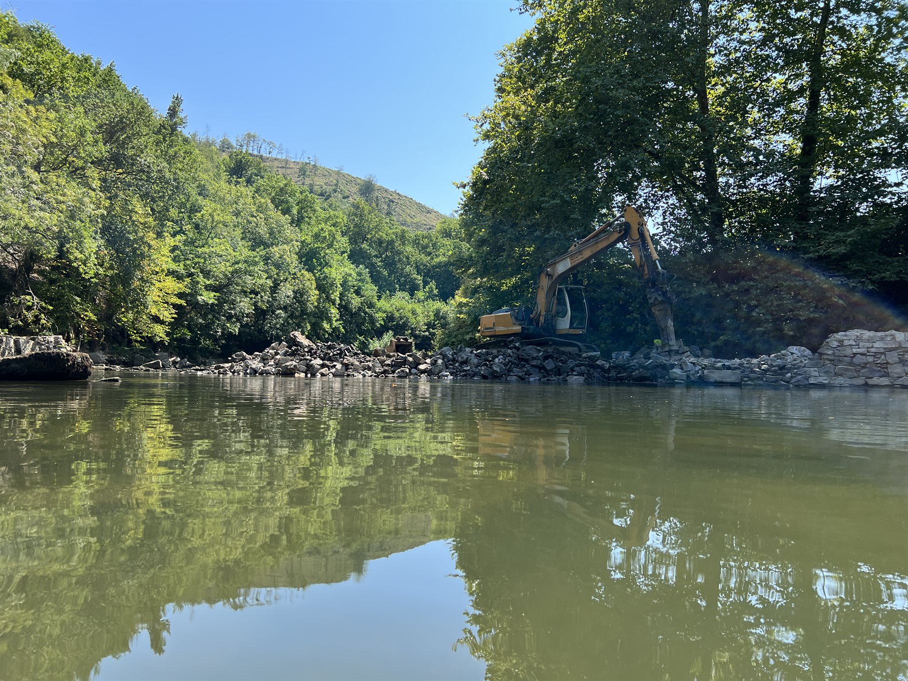
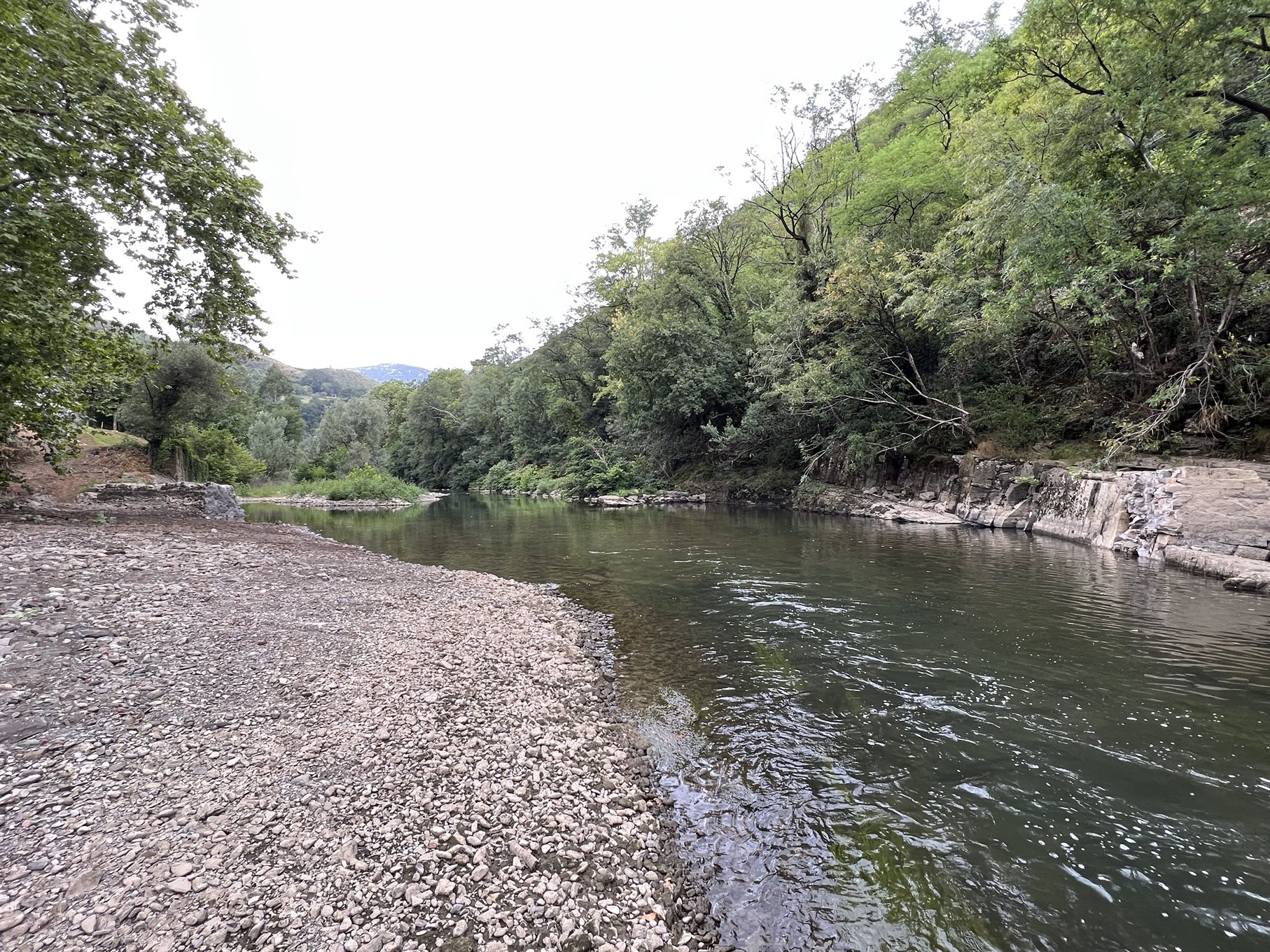
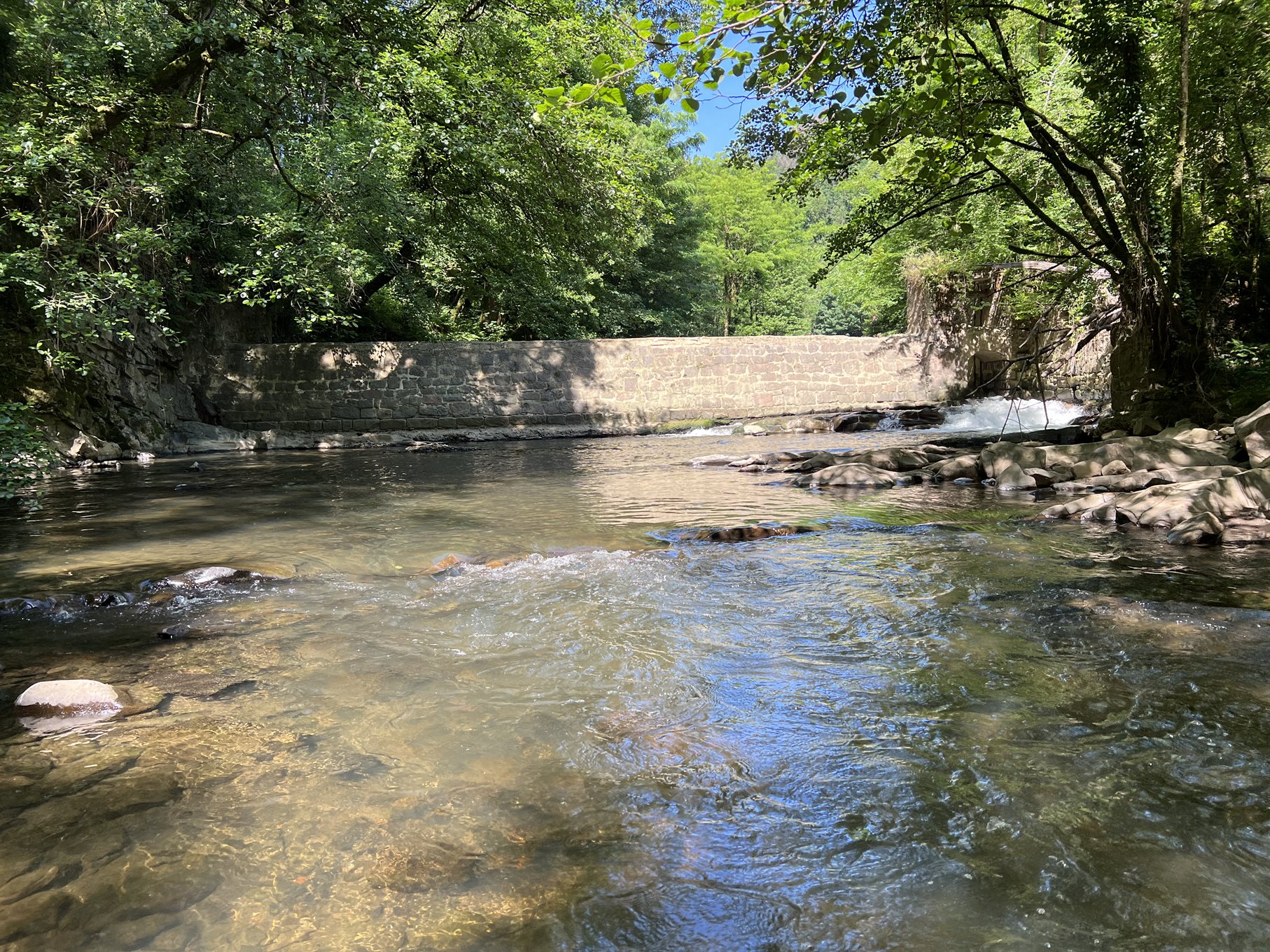
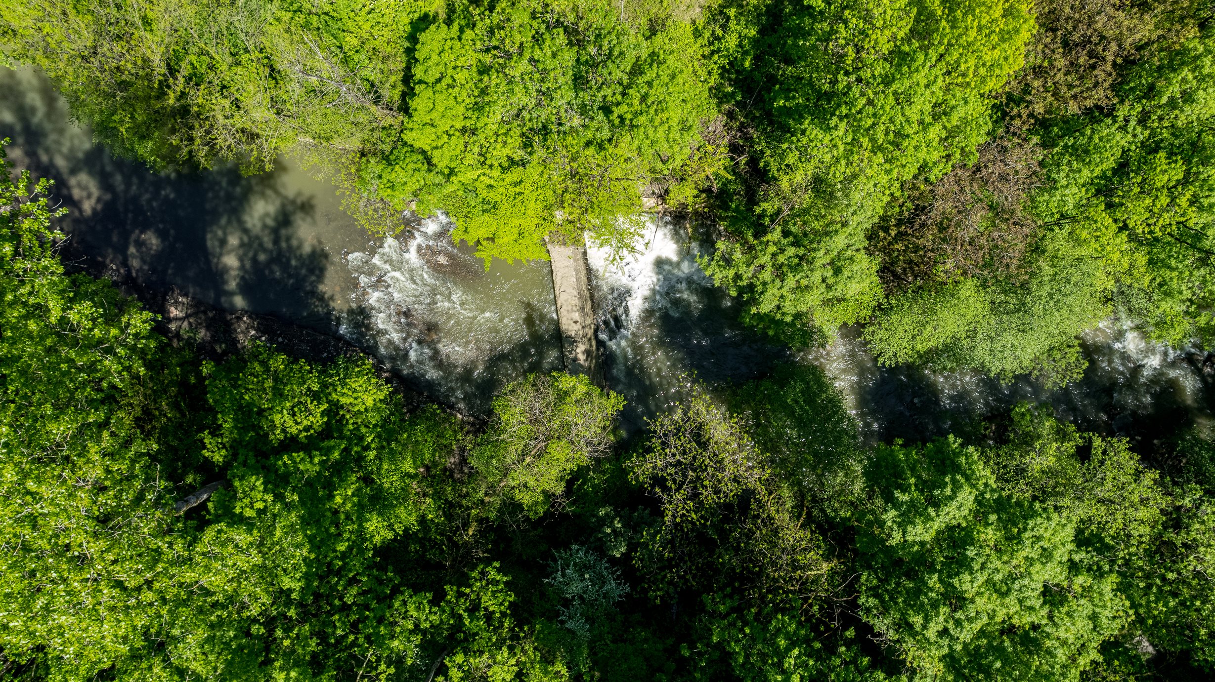
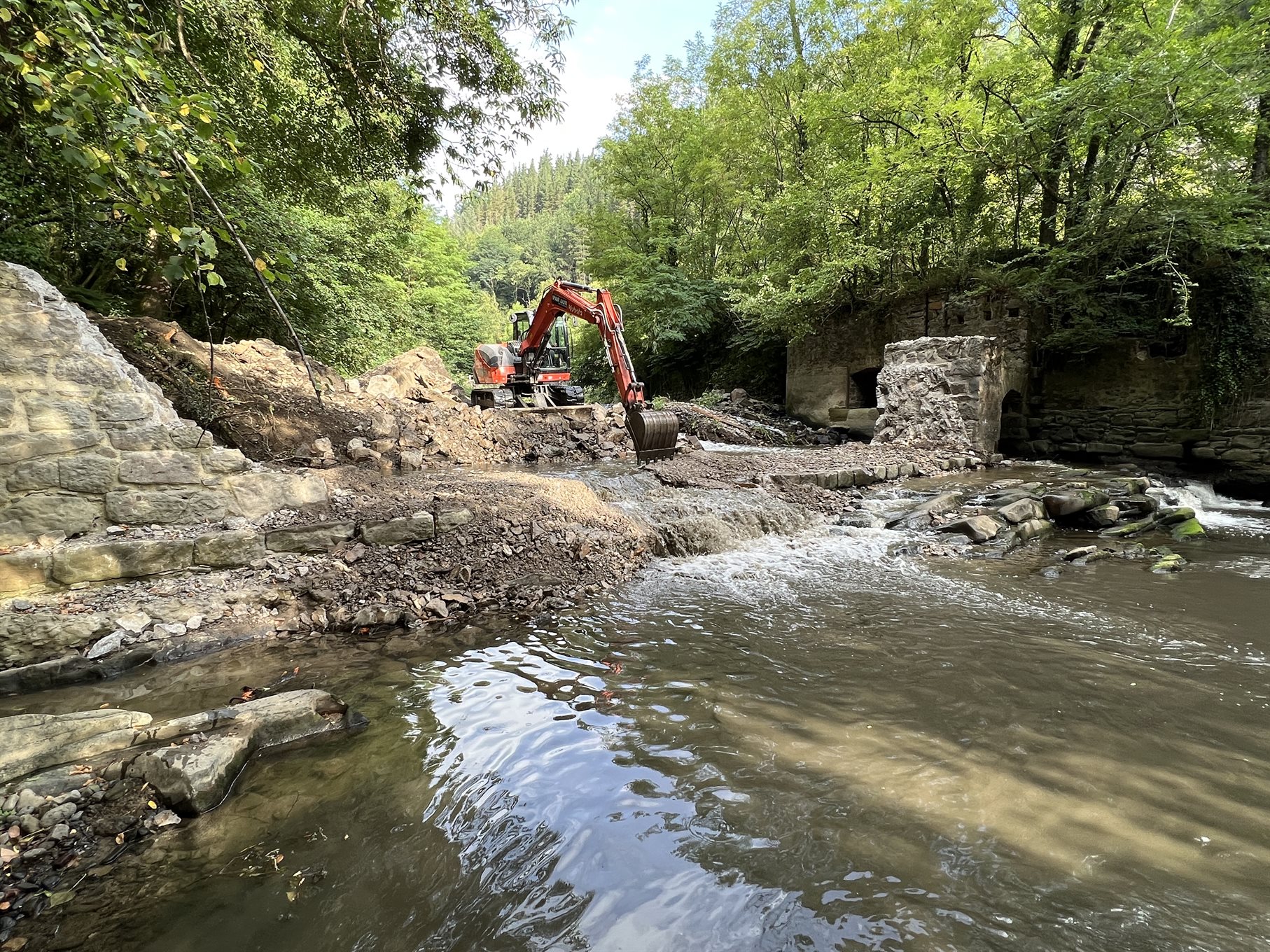
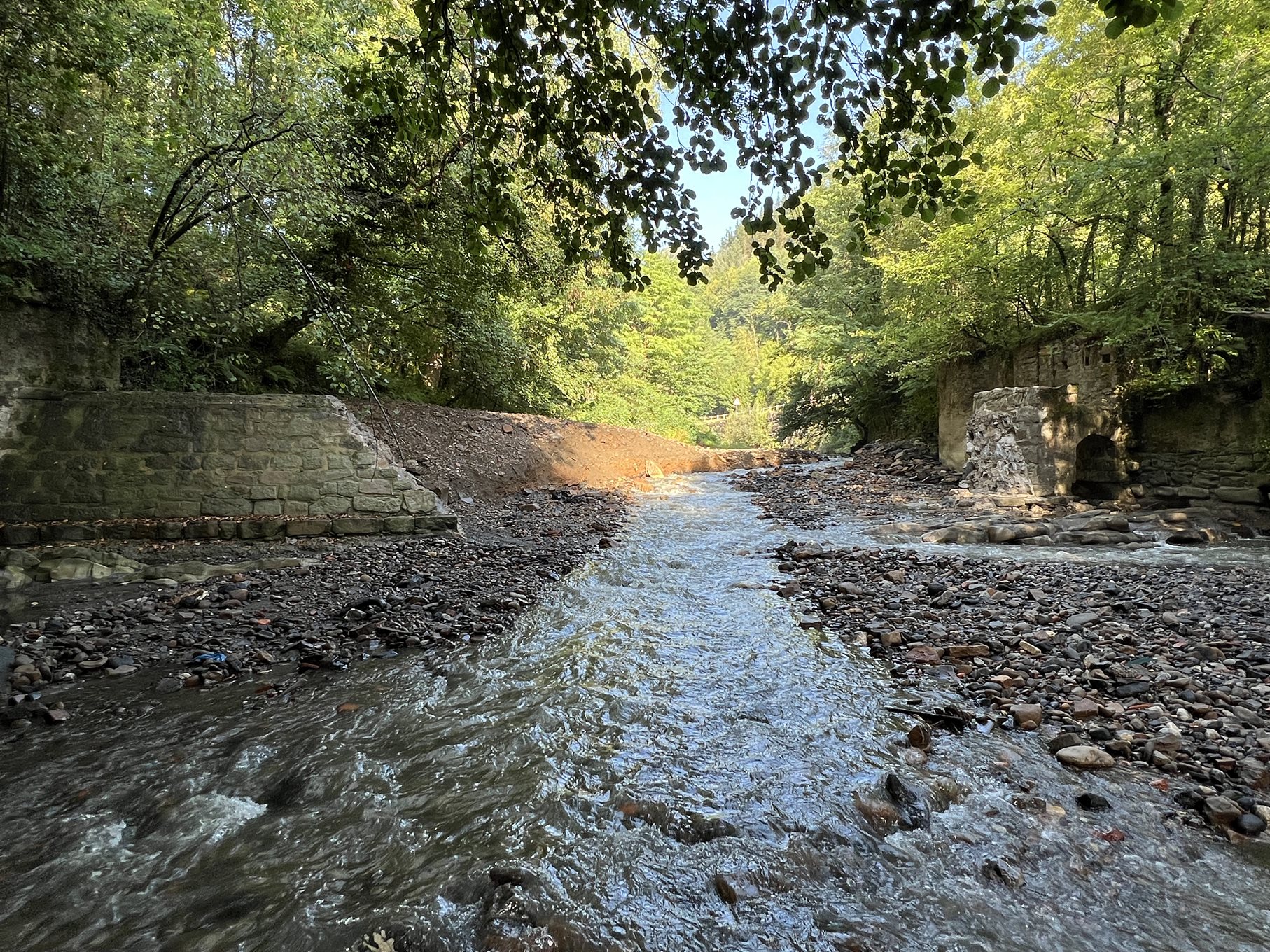
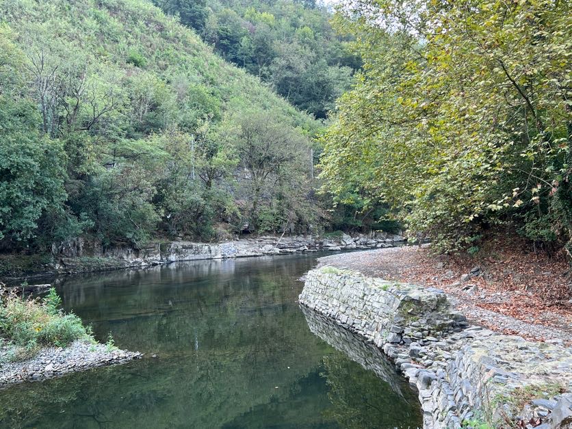
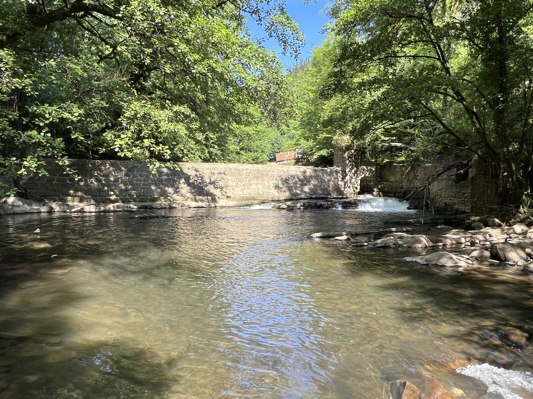
Alzolabea and San Prudentzio dam removals – Part of the River Deba basin restoration project


The River Deba
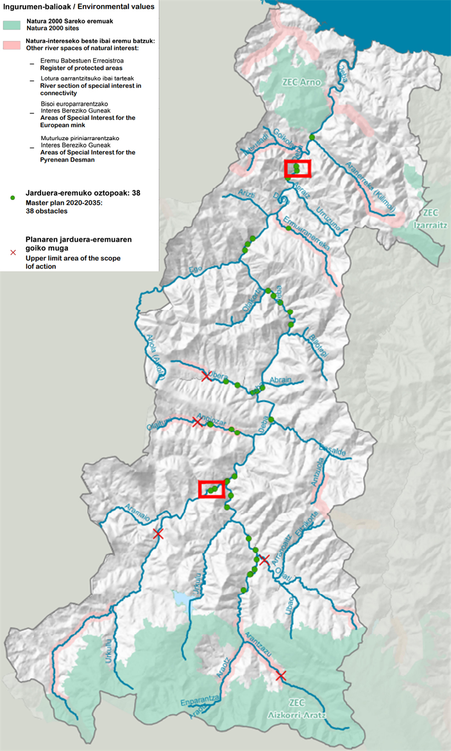
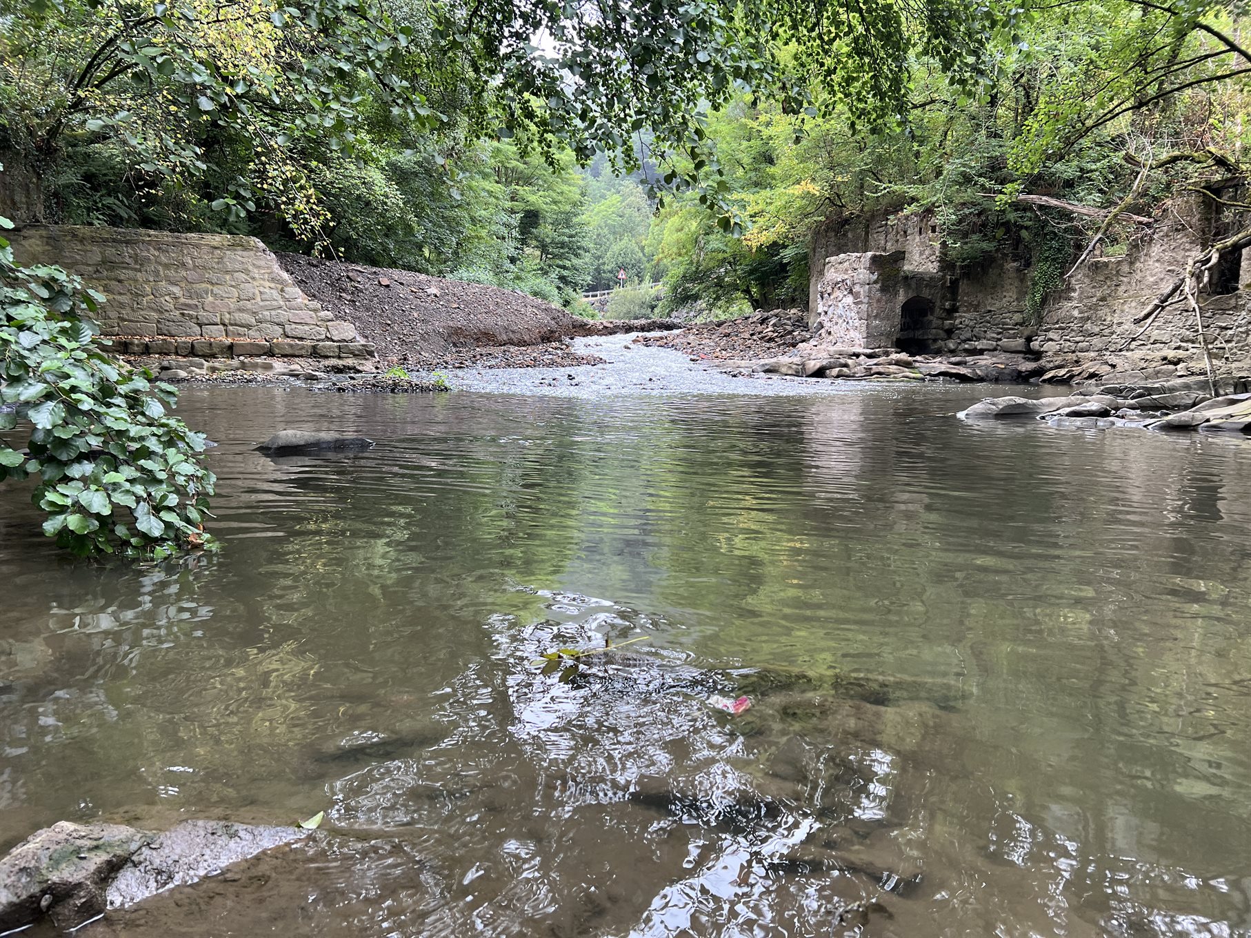
River Deba (Basque: Deba ibaia; Spanish: río Deva) is located in the Basque Country in Spain. It rises in Arlaban and flows into the Atlantic Ocean, in the Bay of Biscay, in Gipuzkoa Province (Figure 1). Its basin covers an area of 534 km2 and includes urban, peri-urban and agricultural areas, while ~135000 people live within it. The lowest section of River Deba borders with the ZEC Arno Natura 2000 site, while many of Deba’s tributaries spring from the ZEC Izarraitz and ZEC Aizkorri Aratz Natura 2000 sites (Figure 1). In addition, many of Deba’s tributaries are characterized as sites of natural interest; they are registered protected areas, sections of special interest in connectivity, areas of special interest for the European mink (Mustela lutreola) or areas of special interest for the Pyrenean desman (Galemys pyrenaicus), a small semiaquatic mammal related to moles and shrews. The former is characterized by the IUCN (International Union for Conservation of Nature’s) Red List of Threatened Species as critically endangered, while the latter as threatened.

Figure 1. The River Deba basin in the Basque Country, Spain. Natura 2000 sites, areas of special interest and the location of barriers are shown. The locations of Alzolabea and San Prudentzio dams are indicated by red rectangles (upper and lower, respectively)

During the second half of the 20th century, River Deba was extremely polluted to the point that it was totally devoid of fish. The main sources of pollution came from urban areas and were of industrial origin. Water quality was significantly improved in the 21st century (Figure 2) due to proper treatment resulting in a notable recovery of biological quality (Figure 3).

Figure 2. Annual measurements of physicochemical quality in San Prudentzio (River Deba)
Figure 3. Annual measurements of biological quality (IBMWP index) downstream of Bergara (River Deba)

Despite the improvements and the return of fish to the river, longitudinal river fragmentation remains a serious issue for the whole basin (Figure 4). Tens of dams throughout the basin, most of them obsolete for decades, block fish migration, alter natural habitats and increase the risk of flooding. The detrimental effects of these barriers have not been assessed individually since in most cases were constructed consecutively (Figure 4). However, fish species richness evidently declines from the river mouth (A. Ab. Mendaro) towards its sources (Epelet) (Figure 5). Additionally, a dramatic drop in the density of catadromous fish, such as European eel (Anguilla anguilla), has been observed from sea to source (Figure 6).

Figure 4. Fragmentation of the River Deba basin in the Basque Country, Spain due to riverine barriers. The locations of Alzolabea and San Prudentzio dams are indicated by red rectangles (upper and lower, respectively)
Figure 5. Fish species richness in River Deba from the river mouth (A. Ab. Mendaro) towards its sources (Epelet). The relative locations from river mouth of Altzolabea and San Prudentzio dams are also shown
Figure 6. Density of European eel Anguilla anguilla in River Deba from the river mouth (A. Ab. Mendaro) towards its sources (Epelet). The relative locations from river mouth of Altzolabea and San Prudentzio dams are also shown

Barrier removals

  • Alzolabea Dam was located close to the River Deba mouth (Figures 1 & 4). It was a 1.5 m high, 56 m long and 3.5 m thick masonry dam (Figure 7). Since the 1910s it was used by the Alzolabea Hydroelectic Power station to supply electricity to the municipalities of Elgoibar and Alzola. However, it remained obsolete for years prior to its removal. The whole removal process of this dam lasted more than a year; the preparatory work lasted for half a year, the acquisition of the permissions required 7 months, while the demolition works (Figure 8, Videos 1-3) were completed within a month (Figure 9). The project costed 27290 euro.
Figure 7. Alzolabea Dam at River Deba, Gipuzkoa Province, Basque Country, Spain (photos by Gipuzkoa Provincial Council)
Figure 8. Demolition works of the Alzolabea Dam at River Deba (photos by Gipuzkoa Provincial Council)
Video 1. Demolition of the Alzolabea Dam at River Deba (video by Gipuzkoa Provincial Council)
Video 2. Demolition of the Alzolabea Dam at River Deba (video by Gipuzkoa Provincial Council)
Video 3. Demolition of the Alzolabea Dam at River Deba (video by Gipuzkoa Provincial Council)
Figure 9. Site after the demolition of the Alzolabea Dam at River Deba (photo by Gipuzkoa Provincial Council)
  • San Prudentzio Dam was located way upstream the River Deba mouth (Figures 1 & 4). Like Alzolabea Dam, it was a 2.4 m high, 22 m long and 3.1 m thick masonry dam (Figure 10). The year it was built is unknown while its purpose is speculated to be the supply of water for a turbine or a power plant. The owner of San Prudentzio Dam was also unknown, and it remained out of use for years prior to its removal. The preparatory work of the project and the acquisition of the permissions lasted for 7 months each, while the demolition works (Figure 11, Videos 4-6) were swift and were completed within a month (Figure 12, Video 7). The project costed 34390 euro.

Figure 10. San Prudentzio Dam at River Deba, Gipuzkoa Province, Basque Country, Spain (photos by Gipuzkoa Provincial Council)
Figure 11. Demolition works of the San Prudentzio Dam at River Deba (photos by Gipuzkoa Provincial Council)
Video 4. Demolition of the San Prudentzio Dam at River Deba (video by Gipuzkoa Provincial Council)
Video 5. Demolition of the San Prudentzio Dam at River Deba (video by Gipuzkoa Provincial Council)
Video 6. Demolition of the San Prudentzio Dam at River Deba (video by Gipuzkoa Provincial Council)
Figure 12. Site after the demolition of the San Prudentzio Dam at River Deba (photo by Gipuzkoa Provincial Council)
Video 7. Site after the demolition of the San Prudentzio Dam at River Deba (video by Gipuzkoa Provincial Council)

Both the removals of Alzolabea and San Prudentzio dams were executed by the Gipuzkoa Provincial Council in collaboration with the University of Basque Country – UPV/EHU within the framework of the EU Horizon 2020 project MERLIN (Mainstreaming Ecological Restoration of freshwater-related ecosystems in a Landscape context: INnovation, upscaling and transformation). The general aim of MERLIN project is to implement transformative ecosystem restoration and to mainstream nature-based solutions.

Ecological and community benefits
The hydro-geomorphological restoration of River Deba aims, through many actions – including barrier removals – to reduce flood risk, mitigate the environment degradation, enhance the biodiversity, restrain climate change, and improve human health. The stakeholders involved in the removals of Alzolabea and San Prudentzio dams included municipal councils, the Basque Country Water Agency (URA), the Society for the Economic Development of Deba Basin (DEBEGESA), the Deba Basin Rural Development Association (DEBEMEN), the Commonwealth of the Upper Deba and the Eibarko Baso Biziak. Through this project, stakeholder interaction has been promoted, as has the connection with local communities, institutions, and governments. Comprehensive monitoring of the water quality, the invertebrate and fish communities, as well as of the whole ecosystem function started after the dam removals, following a BACI (Before-After-Control-Impact) design.

Before & After photo pair

The removal site at River Deba: (left) before and (right) after the removal operations of Alzolabea Dam (photos by Gipuzkoa Provincial Council)

The removal site at River Deba: (left) before and (right) after the removal operations of San Prudentzio Dam (photos by Gipuzkoa Provincial Council)

Written by Foivos A. Mouchlianitis

  • Name: Alzolabea and San Prudentzio dams
  • Location: River Deba, Gipuzkoa Province, Basque Country, Spain
  • Type: dams
  • Dimensions: Height (Alzolabea) 1.5 and (San Prudentzio) 2.4 m; Length (Alzolabea) 56 and (San Prudentzio) 22 m
  • Aim of removal: Restored river connectivity and fish passage, enhanced biodiversity, and improved water quality
  • Year of removal: 2022